Hiking: Appalachian Trail at Tesnetee Gap

Another four miles hiked this past weekend. Greg and I set out on Sunday to hike the Tower Loop Road at Smithgall Woods State Park, we packed our watershoes and a towel and everything in preparation for fording the knee-high creek. But when we arrived at the park, we were greeted with signs “HUNT IN PROGRESS.” Not wanting to get shot with a bow and arrow, Greg and I skedaddled out of there and drove up Richard Russell Scenic Highway to do some hiking on the Appalachian Trail.
The AT touches Richard Russell in a couple of spots. The first place, it actually crosses the road. There’s a nice little parking lot that is consistently full of the cars of folks day hiking or camping somewhere along the trail, but if you go a little further down the road, past the AMAZING OVERLOOK SPOT OF AWE, there’s another, smaller parking lot on the left. This is Tesnatee Gap. The AT merely brushes against the highway here, veering back into the woods for about a mile before crossing at that first spot I mentioned.

This section of the AT, for some unknown reason, is less popular. Which I don’t understand at all. There’s an absolutely amazing vista view less than a mile in. Of course, it’s uphill the entire time, which may dissuade some hikers, but it’s totally worth it!
We typically hike this trail earlier in summer, when the blackberries are in. They grow everywhere around the rock face at the peak, and so there’s been a couple of years where we’ve made a point to get up there during the later part of blackberry season (they grow a couple weeks later up there than in lower elevations) and pick a few bowlfuls, giggling as the hummingbirds dive-bomb us.

This weekend, we went a little further than the initial summit of beauty, and did an extra hilly mile. In and out, we did a smidgen over 4 miles total, with an elevation gain of 1050 ft.
The weather was perfect and visibility was good, but not perfect. We chitchatted with several folks (oddly enough, all from Florida). Overall, it was an awesome hike.


Hike: Slaughter Gap – AT – Jarrard Gap Loop

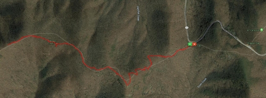
Map showing the Slaughter Gap to AT to Jarrard Gap Loop at Lake Winfield Scott

Today, Greg and I took Beans the Hiking Corgi up to Lake Winfield Scott to hike the Slaughter Gap to Appalachian Trail to Jarrard Gap Loop. Just shy of 6 miles, this hike is a goody.

At the trail head for the Slaughter Gap Trail

We pack up our gear last night so that we could get an early start this morning. We were out of the house by 7:10am and on the trail by 8:10. It was 54 Degrees when we got out of the truck. The chill felt so good, a welcome tease of fall, but the day warmed up quickly. It took us a smidgen over 3 hours to do the 6-mile loop, stopping for a 15 minute break near the half-way point.

This was only the third time we’ve done this hike, but it was the first time for Beans. It was also the first time that we’ve done it without getting lost — the first time was going the opposite way, the trail head for the Jarrard Gap end is kinda hidden… and the sun was in our eyes… and… you know. Stuff. The second time was also starting from the Jarrard Gap end. There is a spot about 1.5 miles in where the trail seemingly forks. Word to the wise – Take the right fork. The left fork will get you there, but it’s a bit more of a climb and a longer trek up a gravel road.

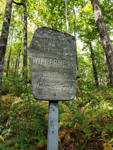
Blood Mountain Wilderness sign on the AT

We had no hiccups this time and Beans enjoyed herself, she even got to play in several of the streams we had to cross.

And even though it was an amazing day, we hardly met any other people on the trail. Early on, we passed a group of very polite young men (possibly scouts), with a couple of chaperones, and then didn’t see anyone else for a couple of hours. Eventually, we came across a few other people (4 in total), and three other pups.

Beans the Hiking corgi playing in a mountain creek.
Beans cooled herself off by taking quick dips in the various creeks.

I love this area, and I love how there are so many trails that interweave with the Appalachian Trail around Blood Mountain.

There were several points on the trail where I just stopped and took a deep breath, letting the fresh mountain air rejuvenate me. There’s nothing quite like hiking through a hilly forest on a cool, low humidity day. I’m ready to tackle this upcoming week.

As the weather cools, we will be hitting the trails more and more around North Georgia.

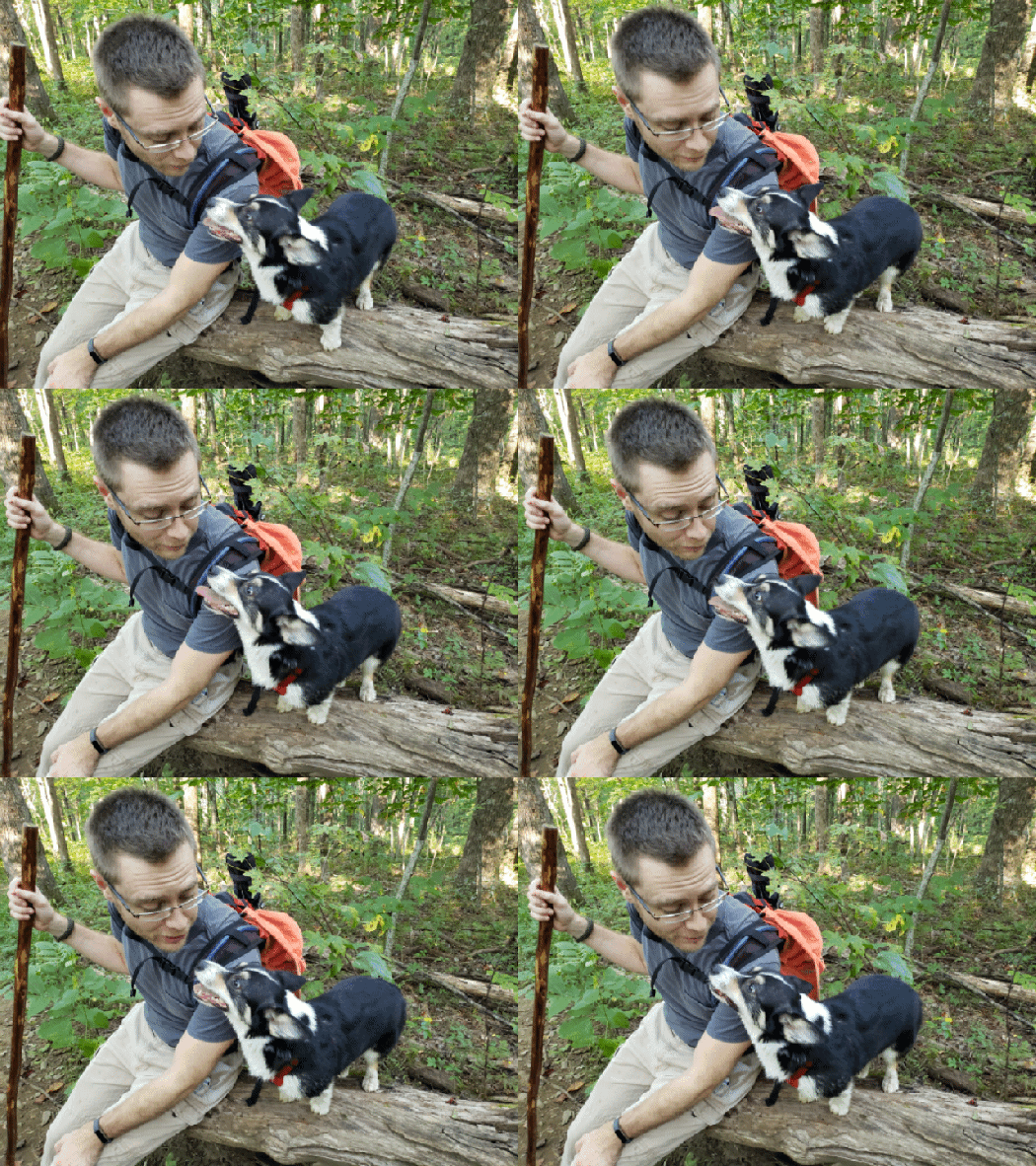
Gif of Greg and beans the Corgi on a fallen tree
Beans and Greg taking a quick sit-down break on a fallen tree

More pictures from the trail:

This slideshow requires JavaScript.

Indian Grave Gap to Tray Mountain

Greg and I have completed two hikes so far in 2019, and both have been brand new to us. This past weekend, we made our way to a remote spoton the Appalachian trail – where the trail crosses Indian Grave Gap Road. Indian Grave Gap Road is a narrowish dirt road that winds through the national forest. If you decide to visit it, I recommend a truck or suv, especially after hard rains like we’ve experienced here in North Georgia lately.

Where the AT crosses the road, there is a small parking lot. We geared up and headed north towards Tray Mountain.

Tray Mountain is the 7th highest peak in Georgia. The trail up to the peak is moderately difficult, and a near constant incline. But it is an awe-inspiring trail with canopies of mountain laurel and rhododendron that give way to breathtaking views. Eventually leading to the very top of Tray Mountain at 2.55 miles (the shelter is as little further down the trail, but we didn’t go that far). This trail has become an instant favorite.

Fall Hike: Or “Let’s go this way”

Sometimes you have to stare at Google maps and try to find a new and interesting place to go hiking. Follow the Appalachian trail north of your normal treks and you may discover a new section that has a road and approach trail that leads right to it.

That’s how we discovered the Appalachian Trail at Addis Gap. The plan was to head to the trail head at the end of Wild Cat Road and hike up to the A.T. and then go for distance.

The drive there was bordering on magical. Peak color, an undisturbed dirt road covered in yellow leaves, and even a water fall along the way. It took a solid 30 minutes to drive down the long, narrow gravel road known as West Wild Cat Rd, and it was certainly a beautiful adventure.

This slideshow requires JavaScript.

After being on approach trail (the old end portion of Wild Cat Road) for about 15 minutes, we were met by a couple of cyclists, which meant we had to scramble and get the pups out of the way (we had Scotch and Beans with us). The second dude who road by let us know that more folks on bikes were coming down the mountain.

There was a race going on.

Our secluded hike was going to be interrupted by a lot of people in tight shorts, and our nerves were going to be shot by trying not to have a corgi vs. bike accident.

But we trudged on, luckily being able to see a relatively good distance along the path.

But behold! a fork in the trail. To the left, the continuation of Wild Cat Road/approach trail. To the right, though, was another old forest road, showing up on Google Maps as “Deep Gap Road.”

When we got to the fork, our decision was basically made for us. A large group of cyclists were speedily coming down the mountain from the approach trail. We took the road less traveled, and honey, that made all the difference.

This slideshow requires JavaScript.

The rest of the hike was peaceful, and while we were constantly climbing the mountain, the grade was easy. So while we didn’t exactly get to the A.T. this time, we found a place where we can come back to later.

In total, we hiked five miles (2.5 in, 2.5 out). We enjoyed it immensely, and the pups did as well.

Hiking the A.T.

The mountains of Northeast Georgia provide an amazing array of hiking choices for those who are outdoorsy-inclined. Hiking is one of my favorite weekend activities, especially during the cooler weather. After almost a full week of feeling almost like a normal human being, I wanted to take a real hike this weekend and not just a jaunt through the woods at Unicoi State Park.

So early on Sunday morning, Greg and I packed up our gear and our snacks and headed up the mountain on the Richard Russell Scenic Parkway nearby. This highway gets closed quite often during the winter months because certain parts never see direct sunlight and ice sticks around like crazy. We drove up to the top of the mountain, to where the Appalachian Trail crosses the road at Hog Pen Gap. From that particular trail head, we headed north for 2 miles and then returned.

GPS map of the hike

A nice, relatively flat 4-mile hike was exactly what I needed for both my body and my spirits. The morning was absolutely invigorating, albeit a bit chilly at first. The trail follows a ridge, and we were hiking in fog for a good portion of the morning, watching it slowly evaporate as the sun rose over the mountains and peeked through the trees.

I feel a unique sort of peace while hiking, and there’s an added bonus of accomplishment when you’re done.

Oddly enough, this is the first time we’ve done this portion of the A.T. I’d like to return eventually and go a littler further than 2 miles in.

This slideshow requires JavaScript.