Hiking: Appalachian Trail at Tesnetee Gap

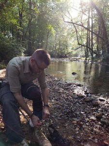
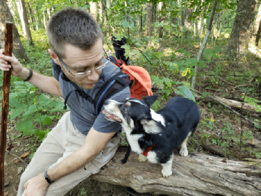
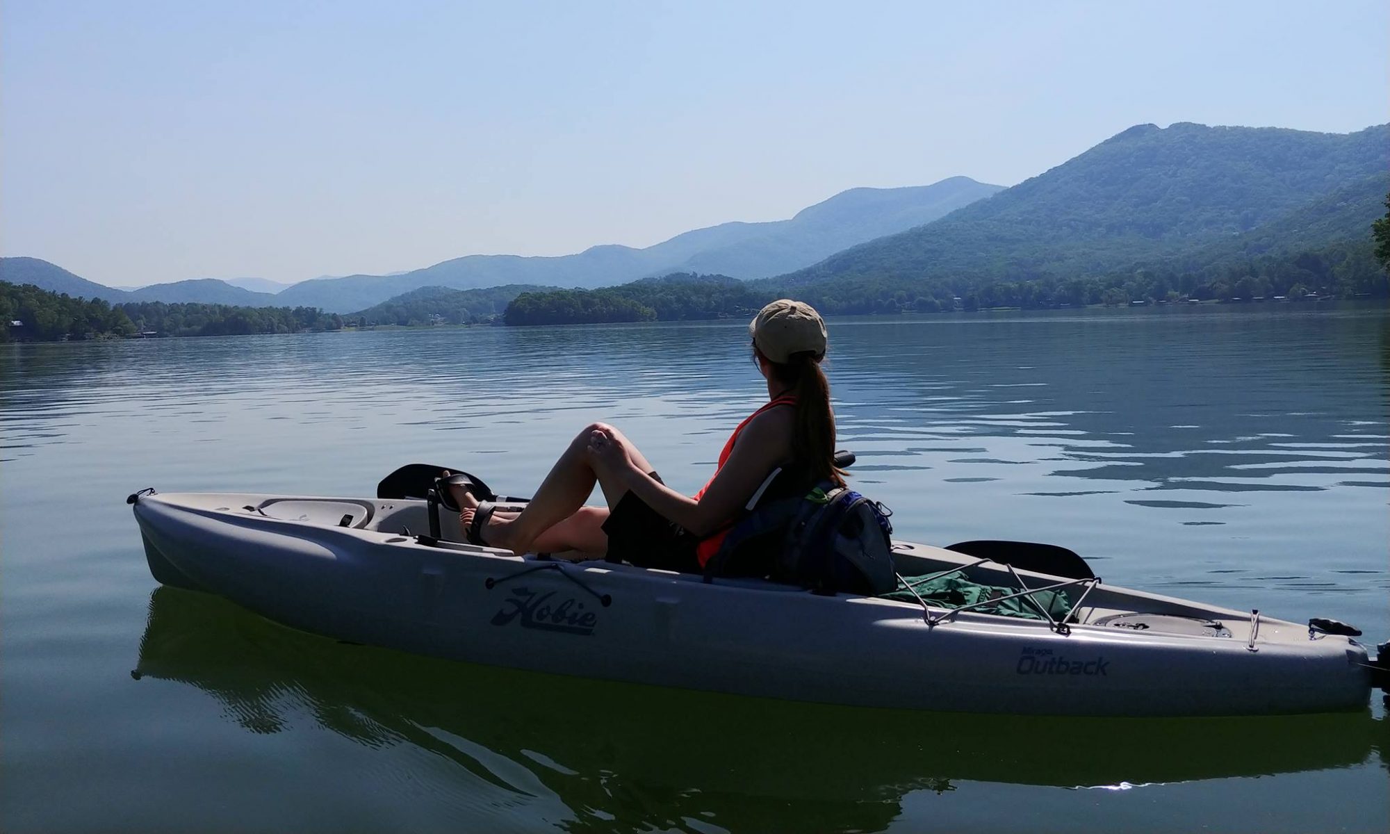
Another four miles hiked this past weekend. Greg and I set out on Sunday to hike the Tower Loop Road at Smithgall Woods State Park, we packed our watershoes and a towel and everything in preparation for fording the knee-high creek. But when we arrived at the park, we were greeted with signs “HUNT IN PROGRESS.” Not wanting to get shot with a bow and arrow, Greg and I skedaddled out of there and drove up Richard Russell Scenic Highway to do some hiking on the Appalachian Trail.

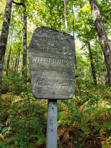
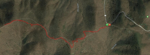
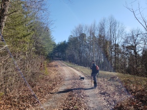
The AT touches Richard Russell in a couple of spots. The first place, it actually crosses the road. There’s a nice little parking lot that is consistently full of the cars of folks day hiking or camping somewhere along the trail, but if you go a little further down the road, past the AMAZING OVERLOOK SPOT OF AWE, there’s another, smaller parking lot on the left. This is Tesnatee Gap. The AT merely brushes against the highway here, veering back into the woods for about a mile before crossing at that first spot I mentioned.

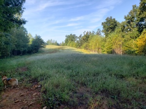
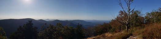
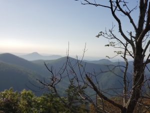
This section of the AT, for some unknown reason, is less popular. Which I don’t understand at all. There’s an absolutely amazing vista view less than a mile in. Of course, it’s uphill the entire time, which may dissuade some hikers, but it’s totally worth it!

We typically hike this trail earlier in summer, when the blackberries are in. They grow everywhere around the rock face at the peak, and so there’s been a couple of years where we’ve made a point to get up there during the later part of blackberry season (they grow a couple weeks later up there than in lower elevations) and pick a few bowlfuls, giggling as the hummingbirds dive-bomb us.

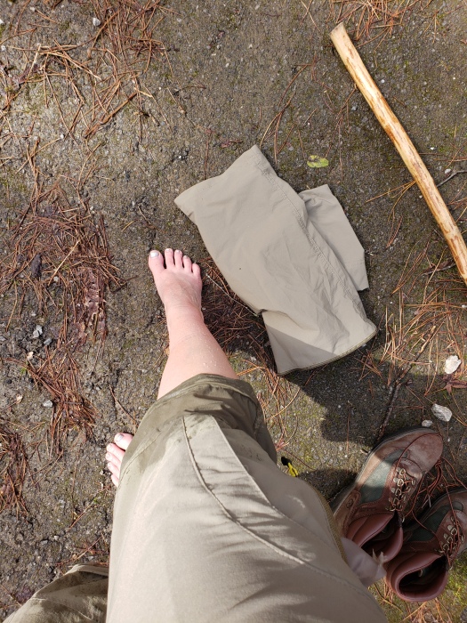
This weekend, we went a little further than the initial summit of beauty, and did an extra hilly mile. In and out, we did a smidgen over 4 miles total, with an elevation gain of 1050 ft.

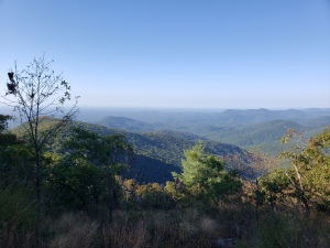
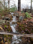
The weather was perfect and visibility was good, but not perfect. We chitchatted with several folks (oddly enough, all from Florida). Overall, it was an awesome hike.


Hike: Ash Loop Trail at Smithgall Woods State Park

GPS map of Ash loop Trail

Greg and I are on day 3 of a week-long vacation. Keeping to a typical Sunday ritual, we left out early this morning to hike at Smithgall Woods State Park outside of Helen, GA. There are several options to choose from, but today, we decided to go on the Ash Loop Trail.

Covered Bridge at Smithgall Woods
I love the covered bridge at Smithgall Woods State Park

Scotch was the lucky corgi who got to go on the hike with us today. He’s getting older, and arthritis is starting to affect him. However, he’s been doing really good with his meds and it’s been a long time since he’s gotten to go hiking. We chose the Ash Loop Trail because it isn’t too strenuous (only a 615 ft elevation change). Clocking in at just a hair under 4 miles (3.96), it is long enough for the humans to feel like we accomplished something and short enough to where our buddy boy Scotch could make the journey without injury.

Purple flowers with blurred background
Purple flowers along Tsalaki trail near the wetland area.

From the visitor’s center, we hiked down Tsalaki Trail (the paved road that runs through Smithgall) to the southern trailhead for the Ash Creek Loop. We prefer hitting the south end first because you do have to wade through the creek at one point on the trail, near the northern end of the trail, so we like to keep it for later in the trip.

It’s rained here a little bit the past couple of days. Enough to settle the dust a bit, but not much else. It hasn’t been helpful with the heat or the humidity. This morning, while not miserable, was sticky. I’m glad we were on the trail by 8am and finished by 10am. Much later and it would have been uncomfortable, even in the woods.

Clearing on top of a hill. A corgi runs in the bottom left corner
One of the clearings on the trail.

Oddly enough, we didn’t see a single other (human) soul during our time at the state park this morning. Only one other car was parked in the parking lot as we were leaving. Smithgall is usually a more hopping place, especially with Octoberfest activities going on in Nearby Helen.

While we met no humans, we did see and come face-to-face (literally) with several spiders and a couple rafters of turkey.  (Yup, a group of turkeys is called a “rafter.” I totally had to Google that one.)

A Corgi in a creek, lapping up water
Scotch taking a quick dip and drink in the Creek

One of the things about the trails at Smithgall that make these hikes interesting is that on several of them, you have to ford one or more creeks. On Ash Creek Loop, you have to go through two. The first one (if you start from the south) is tiny and if your boots are water-proofed, you can just splash through it no problem. The second one, though, it deeper than it looks. The first time Greg and I did this trail, we were unprepared. We hiked up our pants, took off our boots, and waded across barefoot with two corgis swimming beside us (Twinkie and Scotch). This time, we were better prepared.

Greg sitting by the creek, putting his boots back on
Greg sitting by the creek, putting his boots back on.

Zip off pants – Check.

Watershoes to change into – Check.

Folding tripod trail chairs to make changing shoes easier – Check.

Soon after wading through the creek, we returned to the paved part of Smithgall Woods and made our way back to the visitor’s center parking lot.

A fun way to start our Sunday. Afterwards? Nachos and vegging on the couch. Sundays afternoons are made for relaxing and re-energizing.

More Pictures from the trail:

This slideshow requires JavaScript.

Hike: Slaughter Gap – AT – Jarrard Gap Loop

Map showing the Slaughter Gap to AT to Jarrard Gap Loop at Lake Winfield Scott

Today, Greg and I took Beans the Hiking Corgi up to Lake Winfield Scott to hike the Slaughter Gap to Appalachian Trail to Jarrard Gap Loop. Just shy of 6 miles, this hike is a goody.

At the trail head for the Slaughter Gap Trail

We pack up our gear last night so that we could get an early start this morning. We were out of the house by 7:10am and on the trail by 8:10. It was 54 Degrees when we got out of the truck. The chill felt so good, a welcome tease of fall, but the day warmed up quickly. It took us a smidgen over 3 hours to do the 6-mile loop, stopping for a 15 minute break near the half-way point.

This was only the third time we’ve done this hike, but it was the first time for Beans. It was also the first time that we’ve done it without getting lost — the first time was going the opposite way, the trail head for the Jarrard Gap end is kinda hidden… and the sun was in our eyes… and… you know. Stuff. The second time was also starting from the Jarrard Gap end. There is a spot about 1.5 miles in where the trail seemingly forks. Word to the wise – Take the right fork. The left fork will get you there, but it’s a bit more of a climb and a longer trek up a gravel road.

Blood Mountain Wilderness sign on the AT

We had no hiccups this time and Beans enjoyed herself, she even got to play in several of the streams we had to cross.

And even though it was an amazing day, we hardly met any other people on the trail. Early on, we passed a group of very polite young men (possibly scouts), with a couple of chaperones, and then didn’t see anyone else for a couple of hours. Eventually, we came across a few other people (4 in total), and three other pups.

Beans the Hiking corgi playing in a mountain creek.
Beans cooled herself off by taking quick dips in the various creeks.

I love this area, and I love how there are so many trails that interweave with the Appalachian Trail around Blood Mountain.

There were several points on the trail where I just stopped and took a deep breath, letting the fresh mountain air rejuvenate me. There’s nothing quite like hiking through a hilly forest on a cool, low humidity day. I’m ready to tackle this upcoming week.

As the weather cools, we will be hitting the trails more and more around North Georgia.

Gif of Greg and beans the Corgi on a fallen tree
Beans and Greg taking a quick sit-down break on a fallen tree

More pictures from the trail:

This slideshow requires JavaScript.

Hike: Smithgall Woods Loop

After spending about 10 days with one illness or another, last Saturday, Greg and I were feeling peak cabin fever. On top of that, it was a gorgeous day. So we talked about going for a hike – you know, a short, easy going hike to ease ourselves back into things.

We did 7.5 miles. And not a flat 7.5 miles. It was hilly, with an elevation change of 700ft from lowest to highest.

We use A LOT of tissues.

A few weeks ago, we had explored a new part of The Smithgall Woods Center State Park – the Tower Road. At the time, we went for time and just kinda rambled about. But later, we discovered that if you continue on that road and then make the correct turns, you can make that hike into a loop. So that’s what we did.

Everything was going swimmingly. It was a nice, warm day after a whole bunch of rain. We were happy to get out and enjoy the day — until we were about 2 miles from the end. We were walking along the graveled Shackleford Road, when we came to the creek.

We were NOT turning around. So we zipped off the legs to our pants (AH HA, knew that would come in handy); took off our boots, tied the laces, and put them around our necks; removed our socks and stuffed them into high pockets; and forded our way across the creek. The water came up to my knees and was moving very fast. I have never been so grateful for my hiking stick, because it saved my ass a couple of times.

Blessed be the quick-dry pants

We made it across without incident and then stopped to rest a minute and dry off our feet. Soon, we re-donned our foot gear and continued our way back to the parking lot.

Luckily, we did not have the corgis with us. That would have made things much, much more difficult. We typically do not take them with us on new hikes.

Over all, it was a beautiful and adventurous hike. We saw some butterflies, some tadpoles, and a huge tree with some interesting, old initial carvings in it.


Lake Russell Lady Slipper Trail (ish) Hike

Lake Russell Recreational Area in Mt. Airy, Georgia is a hidden gem, especially in the off season. The trails are quiet and isolated. And even during the months when the park is fully open, the beach area and campgrounds might be crowded, but the trails typically remain little traveled.

One of our favorite trails is the Lake Loop that, you guessed it, circles around the lake. This past weekend, however, we went on one of the other trails – the Lady Slipper Trail.

The Lady Slipper Trail starts off with a steady uphill climb for about a mile. Once you hit the top of the ridge, you merge into an old forest road. The official trail turns left, heading northeast. Greg and I eyed each other, and turned right, heading down the road going southwest into an area of the park we haven’t explored. We did about 3/4 of a mile, reaching the end of the road and going a bit further (a smaller trail continued beyond the end of the road) along the ridge through a pine forest. We would have kept going deeper into the woods, except we came across a hunter and didn’t want to disturb him or his dogs. So, we turned around and headed back.

Wanting to at least go for 5 miles, we hiked beyond where the trail enters the road and continued northeast and veered off onto the Lady Slipper Trail once more, where it departs the road and heads down a hillside. Instead of doing the loop though, we went for distance and then turned around to head back to where we parked.

On our way back, we actually met up with the hunter that we saw at a distance in the woods and exchanged apologies and pleasantries. He had two small hunting dogs with him that were adorable and friendly. Scotch and Beans behaved themselves and everyone had a good sniff. We also met a couple groups of mountain bikers on the return journey – making this the busiest we have ever seen this trail before.

The Lady Slipper Trail is a multipurpose trail. You can hike, bike, or horseback ride on it, so I’m really surprised we haven’t seen a lot more folks on it before.

The day was beautiful and the dogs enjoyed getting to stretch their stubby little legs. It’s been great getting out and hiking more again. I can feel my heart recovering from my last mystery illness flair up, and with each hike, I can feel my body getting stronger and more resilient. Being outside again makes my soul happy.

I am grateful for the abundant outdoor beauty that exists so close to where I live.

Smithgall Hike: Tower Road

On Saturday, Greg and I returned to one of our favorite local destinations – The Smithgall Woods Center for a hike.

Smithgall is awesome because most of the time, the entire park is pedestrian only. So even just getting around in the park is a hike in itself, and there’s several hiking trails off of the main road. It’s a peaceful, less populated state park.

I am happy to say, that the park has fully reopened. Last time we went, most of it was closed because the main road had been washed away, leaving behind a ravine.

This time
Last time

Instead of hitting up one of the normal hiking trails, we decided to take a graveled side road up to a cell tower. The road is aptly named Tower Road. We’d never explored this part of the park before, and I can say for certain that this is definitely the steepest part of Smithgall.

We took the Scotch and Beans and had some fun. After not going hiking or leaving the house much at all these past few weekends, it felt awesome to get out in nature again and really reset myself for the week at hand. Nothing makes me more content than a jaunt through the woods amongst the happy tree pheromones ion thingies (no really – look up “Forest Bathing”)


Indian Grave Gap to Tray Mountain

Greg and I have completed two hikes so far in 2019, and both have been brand new to us. This past weekend, we made our way to a remote spoton the Appalachian trail – where the trail crosses Indian Grave Gap Road. Indian Grave Gap Road is a narrowish dirt road that winds through the national forest. If you decide to visit it, I recommend a truck or suv, especially after hard rains like we’ve experienced here in North Georgia lately.

Where the AT crosses the road, there is a small parking lot. We geared up and headed north towards Tray Mountain.

Tray Mountain is the 7th highest peak in Georgia. The trail up to the peak is moderately difficult, and a near constant incline. But it is an awe-inspiring trail with canopies of mountain laurel and rhododendron that give way to breathtaking views. Eventually leading to the very top of Tray Mountain at 2.55 miles (the shelter is as little further down the trail, but we didn’t go that far). This trail has become an instant favorite.

New Year’s Hike – Unicoi to Helen

Yesterday, Greg and I took full advantage of the holiday and the gloriously mild weather and went for a hike. When you have time off and it’s 63 degrees outside, you go outside and enjoy it!

So warm we didn’t need jackets

It’s amazing that after six years of hiking and exploring all that the mountains of Northeast Georgia has to offer, that we still find places that we’ve never hiked. Especially trails that are definitely ones that should have been on our radar. Yesterday’s hike was one of these. We go to Unicoi State Park in Helen at least once a month. We love taking the pups for a casual stroll around the little lake there, and we’ve explored a bit of the other trails this park has to offer, but we’ve never completed the Unicoi to Helen trail.

Until now.

Coming in at just under six miles in and out, this trail is one that we’ll be adding to the rotation for sure. I’d say it’s only moderately difficult – purely based on length. The climbs and descents are mild. It has been raining A LOT here recently, so the trail itself had several swishy, muddy parts, but nothing that a good pair of waterproofed boots couldn’t slog through easily.

Sign at the Unicoi Lodge Trailhead

The trail starts at Unicoi Lodge in the park and winds up at the city park in Helen, where you can add a little bit of length and site-seeing to the hike by going around the little paved loop in the park.

Because of the weather and time of year, the trail had many different types of fungus and lichen growing everywhere. The rivers and streams were flowing like crazy, several days after we received flood-level amounts of rain.

This was a great, new experience to start of 2019.


Fall Hike: Or “Let’s go this way”

Sometimes you have to stare at Google maps and try to find a new and interesting place to go hiking. Follow the Appalachian trail north of your normal treks and you may discover a new section that has a road and approach trail that leads right to it.

That’s how we discovered the Appalachian Trail at Addis Gap. The plan was to head to the trail head at the end of Wild Cat Road and hike up to the A.T. and then go for distance.

The drive there was bordering on magical. Peak color, an undisturbed dirt road covered in yellow leaves, and even a water fall along the way. It took a solid 30 minutes to drive down the long, narrow gravel road known as West Wild Cat Rd, and it was certainly a beautiful adventure.

This slideshow requires JavaScript.

After being on approach trail (the old end portion of Wild Cat Road) for about 15 minutes, we were met by a couple of cyclists, which meant we had to scramble and get the pups out of the way (we had Scotch and Beans with us). The second dude who road by let us know that more folks on bikes were coming down the mountain.

There was a race going on.

Our secluded hike was going to be interrupted by a lot of people in tight shorts, and our nerves were going to be shot by trying not to have a corgi vs. bike accident.

But we trudged on, luckily being able to see a relatively good distance along the path.

But behold! a fork in the trail. To the left, the continuation of Wild Cat Road/approach trail. To the right, though, was another old forest road, showing up on Google Maps as “Deep Gap Road.”

When we got to the fork, our decision was basically made for us. A large group of cyclists were speedily coming down the mountain from the approach trail. We took the road less traveled, and honey, that made all the difference.

This slideshow requires JavaScript.

The rest of the hike was peaceful, and while we were constantly climbing the mountain, the grade was easy. So while we didn’t exactly get to the A.T. this time, we found a place where we can come back to later.

In total, we hiked five miles (2.5 in, 2.5 out). We enjoyed it immensely, and the pups did as well.

Hiking the A.T.

The mountains of Northeast Georgia provide an amazing array of hiking choices for those who are outdoorsy-inclined. Hiking is one of my favorite weekend activities, especially during the cooler weather. After almost a full week of feeling almost like a normal human being, I wanted to take a real hike this weekend and not just a jaunt through the woods at Unicoi State Park.

So early on Sunday morning, Greg and I packed up our gear and our snacks and headed up the mountain on the Richard Russell Scenic Parkway nearby. This highway gets closed quite often during the winter months because certain parts never see direct sunlight and ice sticks around like crazy. We drove up to the top of the mountain, to where the Appalachian Trail crosses the road at Hog Pen Gap. From that particular trail head, we headed north for 2 miles and then returned.

GPS map of the hike

A nice, relatively flat 4-mile hike was exactly what I needed for both my body and my spirits. The morning was absolutely invigorating, albeit a bit chilly at first. The trail follows a ridge, and we were hiking in fog for a good portion of the morning, watching it slowly evaporate as the sun rose over the mountains and peeked through the trees.

I feel a unique sort of peace while hiking, and there’s an added bonus of accomplishment when you’re done.

Oddly enough, this is the first time we’ve done this portion of the A.T. I’d like to return eventually and go a littler further than 2 miles in.

This slideshow requires JavaScript.